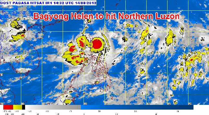
The speed of the storm was estimated to be 85 kph near the center and with gustiness of up to 100 kph.

image: pagasa.dost.gov.ph
- Cagayan
- Isabela
- Apayao
- Kalinga
- Ilocos Norte
- Abra
- Batanes
- Babuyan
- Calayan Groups of Islands
While storm signal number no. 1 has been raised over:
- Aurora
- Quirino
- Nueva Vizcaya
- Ifugao
- Benguet
- Mt. Province
- La Union
- Ilocos Sur
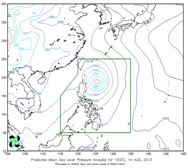
Storm "bagyong" Helen will move to 180 km north of Tuguegarao City or 70 km North of Aparri, Cagayan by Wednesday afternoon and at 380 km northwest of Aparri, Cagayan or 300 km west northwest of Basco, Batanes, according to PAGASA.

picture: pagasa.dost.gov.ph
Extreme Northern Luzon, Isabela and Cagayan will experience stormy weather while the rest of Northern Luzon will have rains with gusty winds and the coastal waters along these areas will be rough to very rough.
Central and Southern Luzon and Western Visayas will experience cloudy skies with scattered to widespread rainshowers and thunderstorms which may trigger flashfloods and landslides.
Mindanao and the rest of Visayas will be mostly cloudy with scattered rainshowers and thunderstorms.
Coastal waters will be moderate to rough.
PAGASA issued a Yellow Warning Signal to Metro Manila at 9:00pm (August 14, 2012). Moderate to heavy rainfall is expected over Metro Manila.
August 14, 2012 - GMA News video update: Zambales suffered continuous rain accompanied with strong wind